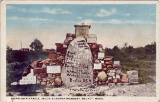
 Jacob's Ladder Trail traverses the scenic southern Berkshires. The scenic byway follows the same rivers and streams that guided native Americans of the Mohican and Woronoake tribes as they traveled between the Connecticut and Hudson River valleys. In 1910, the road was opened as the first highway built specifically for the revolutionary new horseless carriages. Crossing the Berkshires as it does, it was dubbed "the First of the Great Mountain Crossovers,". The Trail attracted automotive pioneers from far and wide to test themselves and their machines against the rugged terrain. Within a few years, the Trail had become a part of a continent-spanning highway linking Plymouth Rock with Seattle Washington, known as the "Yellowstone Trail."
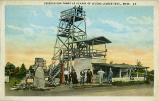
The Trail has evolved in the 100 years since its opening. It gained in popularity with motoring tourists through the decade of the 1920s. With the great depression and World War II, tourism declined. Jacob's Ladder Trail became a major trucking route in the middle part of the century, offering, as it did, an efficient route from Boston and Springfield to Albany and points west. With the inauguration of the interstate highway administration in the Eisenhower administration, plans were developed to build the Massachusetts Turnpike. With the opening of that road, with its higher speeds, multiple lanes and easier grades and turns, Jacob's Ladder Trail became a backwater virtually overnight.
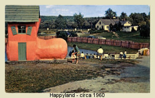
The siphoning of traffic from Jacob's Ladder Trail by the Mass Pike has had a range of effects on the towns along the trail - some good and some not. Gone is the steady flow of truck traffic through the little towns and hamlets, but also gone is much of the economic vitality of the region. The paper, textile and other manufacturing mills that once dotted the Trail are mostly gone. Modern tourists benefit from the shift brought about by the turnpike. The region has been spared much of the development that has transformed other parts of New England, preserving a slice of history.
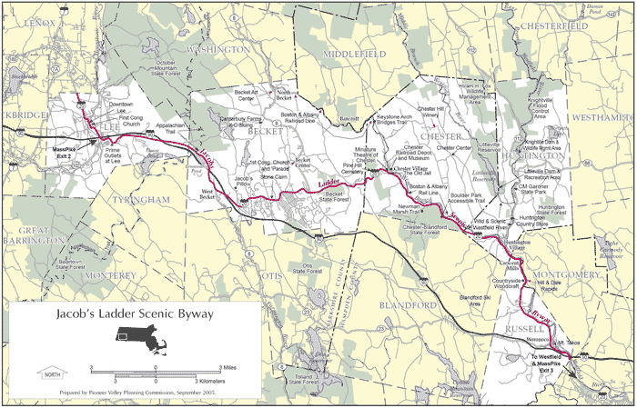
The 35-mile segment of Route 20 from the Lee town common in the west to the Russell/Westfield town line in the east was designated as a state scenic byway by an act of the legislature in 1992 - only the second road in the state (after Route 6A on Cape Cod) to be recognized as such. The designation was extended to the Lee/Lenox town line about ten years later, making the total length of the byway thirty-five miles. A coalition of citizens and professional planners, with support from MassHighway, has worked since the inception of the modern scenic byway designation, to protect the character of the road and its surroundings and to initiate and oversee enhancements.
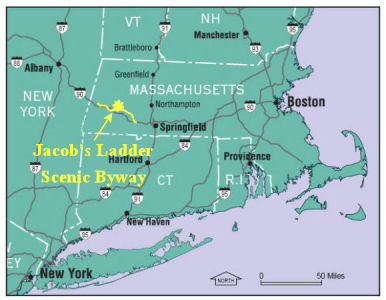
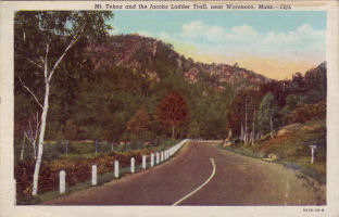 The Jacob's Ladder Scenic Byway is a pleasant alternative to the Massachusetts Turnpike, which it roughly parallels. It winds its way through five towns in the Berkshire Foothills, beginning in Lee, Massachusetts and continuing through Becket, Chester, Huntington and Russell. Also known as the "Jacob's Ladder Trail," the 35-mile stretch of U.S. Route 20 was designated as a scenic byway by the state of Massachusetts in 1992. From the Boston area, it takes only about two hours to reach the Jacob's Ladder Scenic Byway; from New York City, it is about 2½ hours (see "Directions").
 Click here for a printer-friendly version of these directions. (Adobe Reader required)
 From the Berkshires and New York, take the Massachusetts Turnpike to Lee, Exit 2. Go left onto Route 20 (the Jacob’s Ladder Scenic Byway). A sign indicating the entrance to the Byway is located just before the Prime Outlets shopping center.
From northwestern Connecticut, take Route 7 north to Route 102 east in Stockbridge. Route 102 intersects with Route 20 (the Jacob’s Ladder Trail Scenic Byway) in Lee; go east on Route 20. A sign indicating the entrance to the Byway is located just before the Prime Outlets shopping center.
From the Boston or Springfield areas, take the Massachusetts Turnpike to Westfield, Exit 3. Go right onto Route 10/202 south, into Westfield Center. After about 2 1/5 miles (after crossing the Westfield River and immediately after passing under a railroad bridge), turn right on Route 20 west (Franklin Street). You will travel five (5) miles on Route 20 to the border with Russell, where a sign indicates that you are on the Jacob’s Ladder Scenic Byway (note the vast span of the Massachusetts Turnpike bridge passing overhead at this point).
To the Berkshires and New York, Jacob's Ladder Scenic Byway intersects with I-90 (the Mass. Turnpike) about 1/2 mile south of the Lee town common at exit 2. I-90 west connects with the Taconic Parkway and I-87, as well as going through Albany to points west.
To northwestern Connecticut, about 1/2 mile south of the Lee town common and just northwest of the entrance to Prime Outlets at Lee, at the interchange for exit 2 off the Mass. Turnpike (I-90), turn west on Rt. 102. In the center of Stockbridge (after about 4 miles), follow Rt. 7 south to Litchfield County.
To Springfield, Boston and I-91 continue east on Rt. 20 about five miles beyond the Westfield/Russell town line (Mass. Turnpike bridge overhead) to the second traffic light ('T' intersection- you must turn either left or right). Turn left onto Rt. 10/202 (Elm St.). Proceed straight on Rt. 10/202 about 2 1/2 miles to the interchange with I-90 (exit 3 of the Mass. Turnpike). You must turn right (follow the signs) to enter the Turnpike (which is on the left). I-91 (points north or south) is four miles east at exit 4. Continue east on I-90 for Worcester, Boston and points east.
Printer-friendly directions
Map of the Jacob's Ladder Trail Region (letter-size)
Map of the Jacob's Ladder Trail Region (large)
Map of October Mountain State Forest
Map of Chester-Blandford State Forest
Trail guide for the Newman Marsh Trail (Chester-Blandford State Forest)
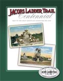
Jacob's Ladder Trail Press Kit (2006)
- Riverfront Visitor Information Center at 1200 West Columbus Avenue, Springfield, MA 01105. Open daily 8 a.m. to 6 p.m. Call 413-750-2980.
- Main Street Visitor Information Center at 1441 Main Street, Springfield, MA 01103. Open Monday-Friday 9 a.m. to 5:00 p.m. Call 1-800-723-1548 or 413-787-1548.
A link from your tourism-related website, or area business website to the Jacob’s Ladder Scenic Byway website can help us in our efforts to promote economic development in our area. To add a link to your website, click on 'select all', copy the selection (control+C or Edit-Copy), and paste it into the appropriate location in the code for your website. Please consider including the following link:
Jacob's Ladder Scenic Byway - Western Massachusetts' historic Route 20